Paradeisos, Thrace (1976)
Published: 2020-06-23
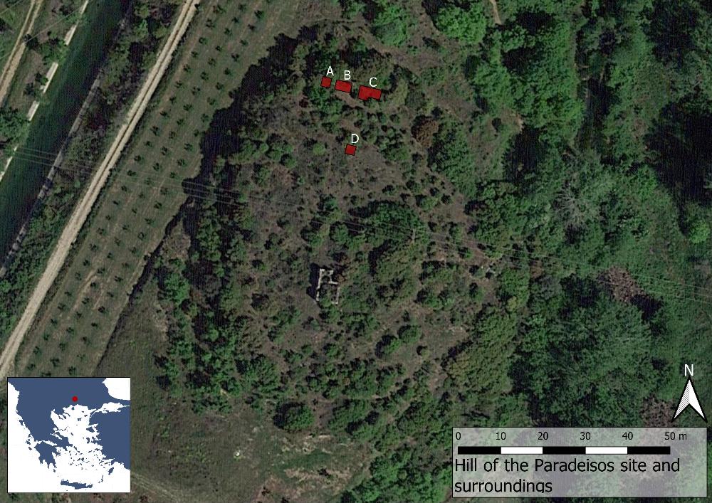
Fig. 1: Map over the site of Paradeisos (Basemap: Google maps satellite image).
Located in the modern region of Eastern Macedonia and Thrace in northern Greece, Paradeisos is situated on a flat hilltop at the west bank of the river Nestos. Today the site is known as Klisi Tepe (a Turkish rendering of the Greek word for church, ekklisia and the word for hill) after the ruin of a Byzantine church on top of it. Just to the north of the hill the Rhodopes mountains rise sharply, while to the south the river has created a large plain, extending 30 km towards the Aegean. In the past the settlement was probably situated much closer to the coastline, which has since expanded. The location is clearly of great strategic importance as the Via Egnatia has crossed the river here at least since Hellenistic times, presumably following an even earlier stretch.
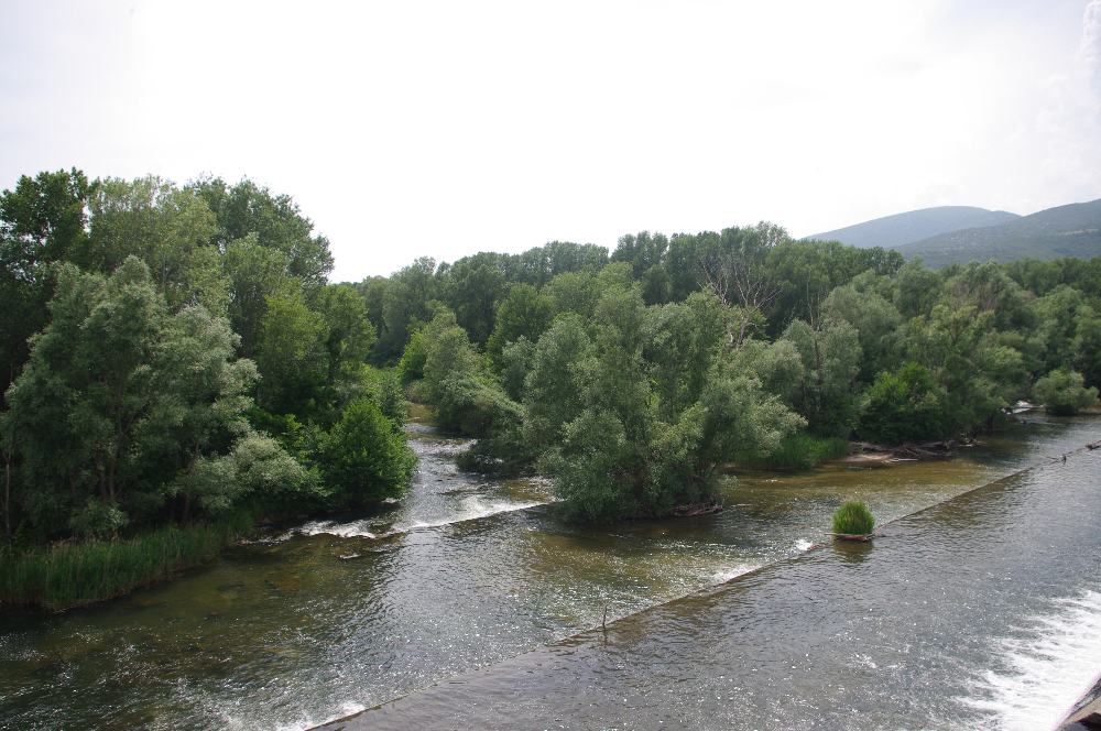
Fig. 2: The Nestos river, flowing just east of Paradeisos.
Excavations
The site was first discovered in 1972 by R. Felsch who noted surface finds indicating the presence of human activity from the Late Neolithic period to the Bronze Age. In November 1975 the Swedish archaeologists Erik Holmberg and Pontus Hellström visited the site during a survey in Thrace, which aimed to increase the number of known prehistoric sites in the region. In particular, Holmberg and Hellström were interested in adding to the knowledge about the Late Bronze Age. They believed Paradeisos to be the most promising site for this purpose and excavations were conducted on this site the following year between September and October. Five small trenches were opened during the campaign, exposing a total area of 27 m2 and finding about 400 kg of pottery. Two of the trenches were later combined into Trench C, while Trench D was closed almost immediately as it reached bedrock after only 15–30 cm.
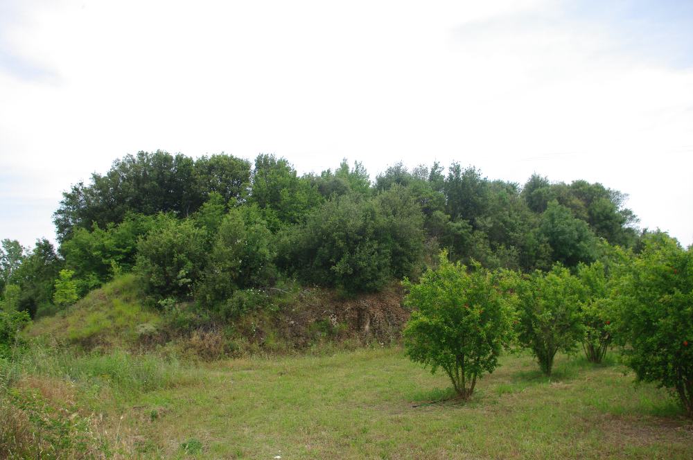
Fig. 3: The Paradeisos hill.
Stratigraphy
Although Holmberg and Hellström wanted to explore the Bronze Age in the region, it soon became clear that the remains at Paradeisos, with seven distinct cultural layers 1.7 m deep in total, dated to the Late Neolithic period. Subsequent radiocarbon dating further showed that the hill was inhabited throughout the 5th millennium BC. However, the excavators believed that the site had been inhabited both before and after this period based on material found out of context.
Throughout the fieldwork the primary find category in all layers was so-called graphite painted pottery. The oldest layer, Stratum 7, rested on the bedrock. On this a piece of daub with impression of branches was found, testifying to an early hut settlement. The pottery consisted of about equal amounts of graphite painted pottery and pottery with impressed or incised decoration. Similar material was found above in Strata 6 and 5. In Stratum 4 the proportion of graphite painted pottery increased to about 60%. The hard bottom of the stratum, with burned soil on top, suggested that it may have been a floor level. Stratum 3 had even more graphite painted pottery (75%), with the rest being of a red-on-black type. A floor (no. 1) could be securely identified in the layer, with a hearth in the south-east corner of Trench B.
Further up, the material in Stratum 2 resembled that in Strata 5–7, while also including five figurines, as well as several blade fragments and bone artefacts. Additionally, two floors (nos. 2 and 3) were identified. On floor no. 2 many animal bones and pottery sherds were found, including several pieced of a heavy cooking stand, suggesting food preparation. More notably, there were remains of burned of bitter vetch, an ancient legume, as well as pine and oak wood. Parts of burned clay and daub testified to the presence of huts in the area. Floor no. 3 was less clearly distinguishable, but small postholes suggests that the huts here had been subdivided by light constructions. On top of Stratum 2 the top soil (Stratum 1) contained mixed material from the Late Neolithic period to the Late Bronze Age, including several figurines, blades and handles from various vessels.
Finds
After the excavations the material was studied in detail, providing insight into life at the site during the Late Neolithic period. The pottery was largely homogenous throughout the strata. It consisted mostly of decorated wares, the most frequent shapes being bowls, both small and large, jars with handles and large plates. Parallels to the material can be found at Late Neolithic sites on the plain of Drama. In terms of decoration only the graphite ware was well preserved enough to elucidate any patterns. The motifs were of a limited range, including lines or groups of lines, chevron patterns and reserved eyes (generally triangular in shape).
The faunal material was dominated by food remains and tool making scraps. The analysis of the bones suggested that the inhabitants of the site were farmers with domesticated sheep, goats, pigs and cattle, with about 50% of the recorded remains coming from sheep and/or goats. Some other animals were also represented in the material, such as dogs, red deer and boars.
The discovered figurines were all from Late Neolithic layers. Four of the figurines depicted humans (three heads and one foot), three represented animals. Another three fragments of figurines could not be identified further. The human faces vary in shape: one has a conical head, another a flat head and pierces ears. The head of the third is oval. The foot is divided into two toes, or possibly two feet next to each other. The animal figurines depict a feline-like creature, something which may be a bear and a potential dog.
Bone artefacts included awls, scrapers and spatulas, all of them, with one exception, being made from mammal legs. Presumably most of these items were used in the treatment of leather and textile production. Stone tools included celts (a type tool resembling an axe head) and blades, among them a 15 cm long knife and the potential teeth of a sickle. A small number of copper items were also found, two of which could be identified as needles. Finally, a single trace of weaponry was discovered at the site, a terracotta sling bullet. While not found in a stratified context the excavators suggested that it belonged to the Late Neolithic period.
Bibliography
Hellström, P. (ed.) 1987. Paradeisos. A Late Neolithic settlement in Aegean Thrace (Medelhavsmuseet Memoir 7), Stockholm.