Dendra, Argolid (1926–1927, 1937, 1939, 1960, 1962–1963)
Published: 2020-05-06
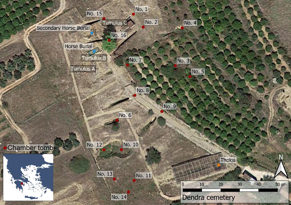
Fig. 1: Map over the site of Dendra (Basemap: Google maps satellite image).
The village of Dendra is located about six km east of the town of Argos in the Argolid. The earliest remains here are of habitation during the Early Neolithic and Early Helladic periods in the form of building foundations and scattered pottery fragments. However, the site is more important archaeologically due to its Bronze Age cemetery, consisting of a tholos, three tumuli and 16 chamber tombs. Overall, it is one of the richest Mycenean cemeteries known. Presumably it was connected to the settlement at ancient Midea, located c. 1.5 km to the south east, although most Mycenean burial places are found closer to their settlements than this.