Asea Valley, Arcadia (1936–1938, 1994–1996, 1997, 2000–2012)
Published: 2020-06-04
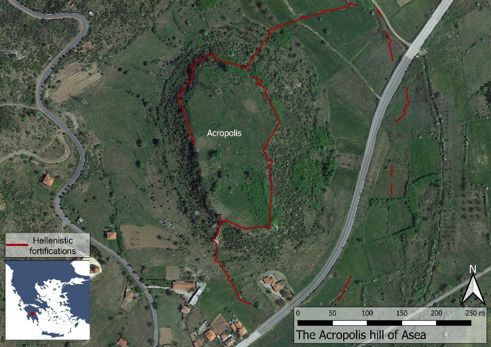
Fig. 1: Map showing the site of Asea and with the line of the Late Classical and Hellenistic fortifications marked in red (Basemap: Google maps satellite image).
The Asea valley is located between the ancient cities of Tegea and Megalopolis in the central Peloponnese. The city of Asea itself, an independent polis between the 6th and 3rd century BC, was located on and around the conspicuous Paleokastro hill at the heart of the valley. The location of the valley is important as it acted as a “main” thoroughfare between Corinthia and the Argolid in the east, and Olympia in the west, during prehistoric and ancient times. Due to few mentions in ancient literature, Asea is mainly known through the archaeological evidence.