Kalaureia, Poros (1894 and 1997– ongoing)
Published: 2020-05-05
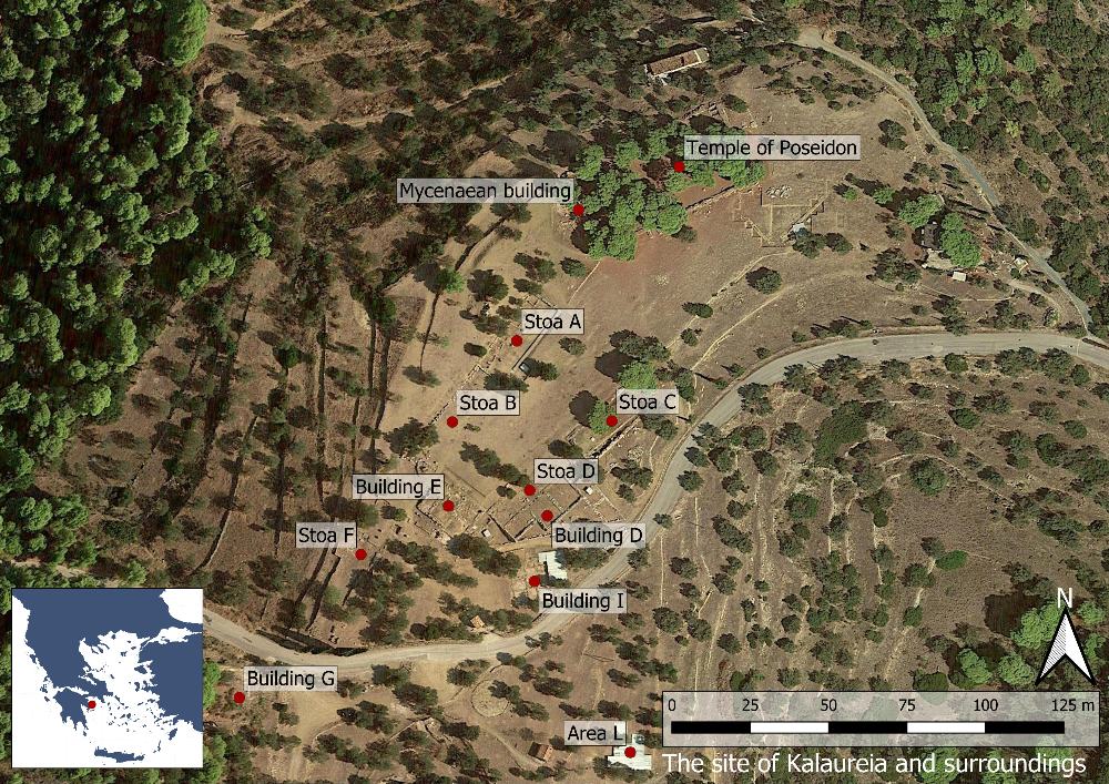
Fig. 1: Map over the site of Kalaureia (Basemap: Google maps satellite image).
The Sanctuary of Poseidon on Kalaureia is located on the island of Poros in the Saronic Gulf, c. 6 km from Poros town. The site lies on a plateau between the hills of Aghios Elias and Vigla and holds a commanding position c. 200 m above sea level. To the north there is a visual connection with the Methana peninsula as well as the islands of Angistri and Aigina, while in the far distance it is possible to see Pireus and the coastline of Attica on clear days. To the south, the visitor can catch glimpses of the sea against the background of the steep Peloponnesian coast.