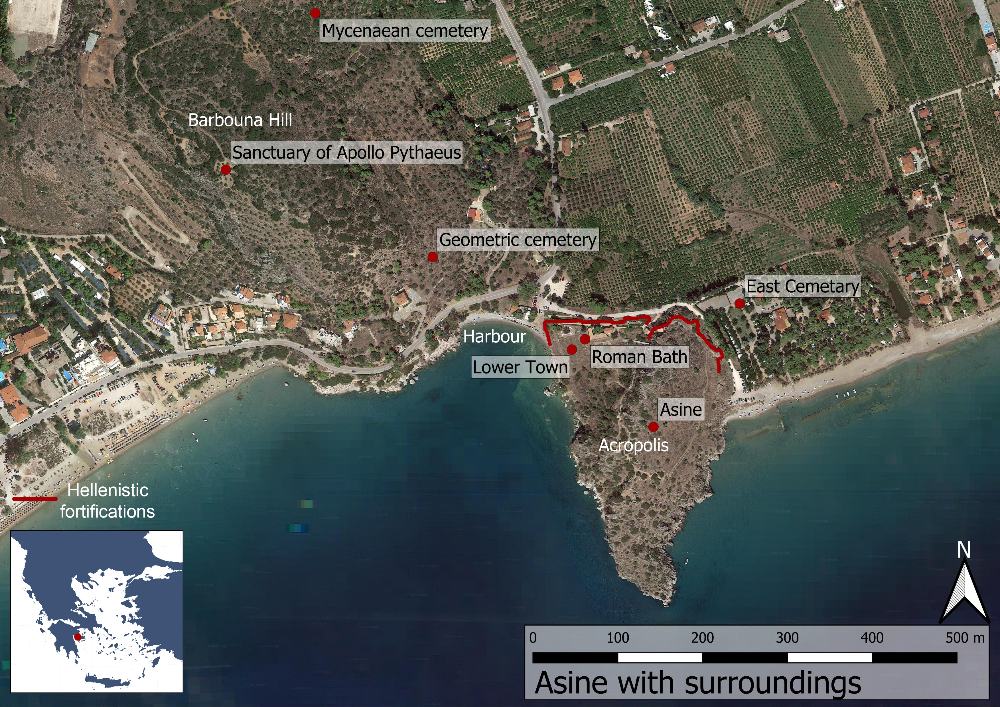
Asine, Argolis 2021
Asine Revisited – A Maritime Archaeological Investigation
Ann-Louise Schallin, Niklas Eriksson, Published: 2022-04-13
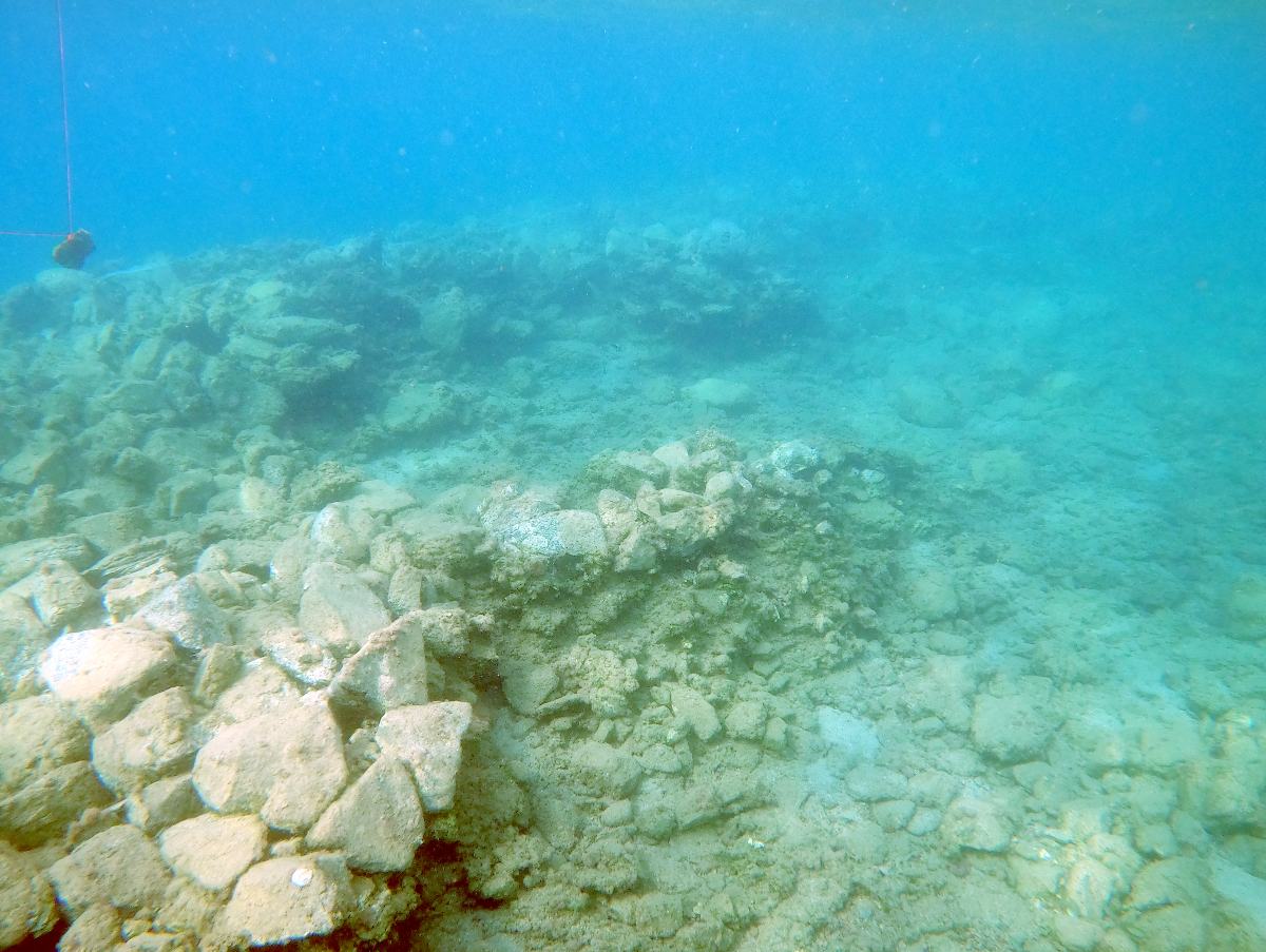
Fig. 1. In the water to the west of the Kastraki promontory there is a built stone platform with presumed building remains. Photograph: Niklas Eriksson.
A pilot underwater archaeological investigation took place in October 2021 in the waters outside Asine and Tolon. The project was a collaboration between the Ephorate of Underwater Antiquities, the Swedish Institute at Athens and Stockholm University, with participants also from the University of Gothenburg and the company Nordic Maritime Group. The project aimed to document the seabed with a so-called “sidescan sonar” (an advanced sonar) and to carry out dives at anomalies that were identified. The project also included an investigation of the seabed around the Kastraki promontory itself, outside the ancient settlement.
The Harbour at Asine – Earlier Interpretations
Possible traces of the harbour at Asine occupied the early excavators of the site in the 1920s. The two field directors Otto Frödin and Axel W. Persson mention a wall-like structure in their 1938 publication, and were inclined to interpret it as a natural formation, although they also indicated the possibility that it could have been used as a harbour and as a breakwater for smaller vessels.
The sea level outside the Kastraki promontory has risen over the past millennia, and water erosion has led to a partial collapse of the Hellenistic city wall into the sea. The fallen blocks are now furthermore stuck in mud and between other stones. It is in other words not easy to determine if underwater formations are natural or manmade.
A Comprehensive Sonar Investigation of the Harbour Area
There are several indications that the harbour at Asine comprised a large area that stretched from east to west, from the Kastraki promontory to the strait between Tolon and Romvi island. From a maritime archaeological viewpoint, harbour areas generally contain rich archaeological remains. In addition to the most apparent components, such as jetties, piers and breakwaters, one may frequently find ballast material (most often stone), anchors and shipwrecks, due to shipwrecks habitually occurring while at anchor, due to storms, leakage or other accidents.
The entire area was mapped with the sonar, and several indications of objects on the seabed were investigated, although they all turned out to be modern remains or natural objects. The absence of shipwrecks, anchors or cultural layers is likely due to sedimentation. The seabed consists of sand that surely conceals older remains.
The Harbour Area To the West of Kastraki
The diving team inspected the water on both sides of the Kastraki promontory. The area was documented with photogrammetry, drone photography and underwater sketches. The most conspicuous archaeological structure is on the seabed, directly connected with the ancient settlement at Asine, and consists of a built “platform” of rocks and smaller stones. In the best preserved northern part of the “platform”, several room-like structures were observed. The impression is that these constitute the remains of smaller buildings that were placed there. The structures on top of the “platform” are difficult to interpret. The wall remains have eroded and are deformed; in some cases the stones have come undone in the mud and form new shapes.
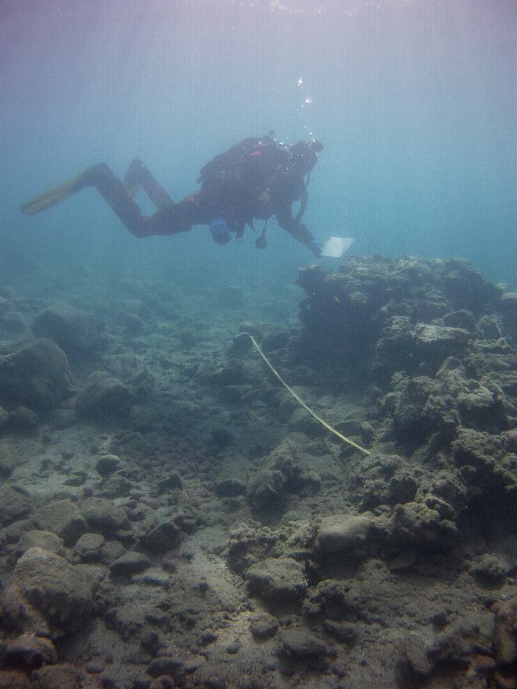
Fig 2. The installations were documented with photogrammetry and traditional drawing underwater. The water depth here is approximately 2,5 metres. Photograph: Staffan von Arbin.
The Future
Above all the harbour area to the west of the Kastraki promontory would require further study in order to enable a better understanding of the function of the “platform” and other possible structures that have been observed on its surface. More in-depth studies will also be required in order to associate the structures with a specific chronological period. We therefore hope to get the possibility to carry out further maritime archaeological work at the site.