From 2024 the Swedish Institute at Athens has been undertaking an archaeological fieldwalking investigation on the small islands of the Saronic Gulf as part of the Little Islandscape of the Saronic Project (LISP), with a permit from the Ephorate of Antiquities of Piraeus and the Islands, under direction of Dr. Christopher Nuttall (Swedish Institute at Athens). LISP is dedicated to documenting the smaller islands of the Saronic Gulf, a region between Attica and the Peloponnese. Despite the wealth of archaeological data on the better-documented larger islands of the region, such as Aigina and Salamis, these smaller islands have been overlooked in academic research. LISP aims to fill this gap by conducting the first comprehensive archaeological survey of this islandscape. As increasing tourism and infrastructure projects drive rapid development in the region, the project seeks to record and understand the islands’ historical roles before these transformations permanently reshape their archaeological record.
The earliest known activity within the study area dates back to the Early Helladic period (c. 3200–2200 BCE) and human activity on Anghistri is attested throughout the Bronze Age (c. 3200–1070 BCE). Habitation on Anghistri was likely closely connected to the nearby major prehistoric settlement at Kolonna on Aigina, though most prehistoric finds on Anghistri relate to sparse ceramic surface material (Dekoulakou 2003, 73). Nothing is yet known about the earlier activity on the other smaller islets in prehistory.
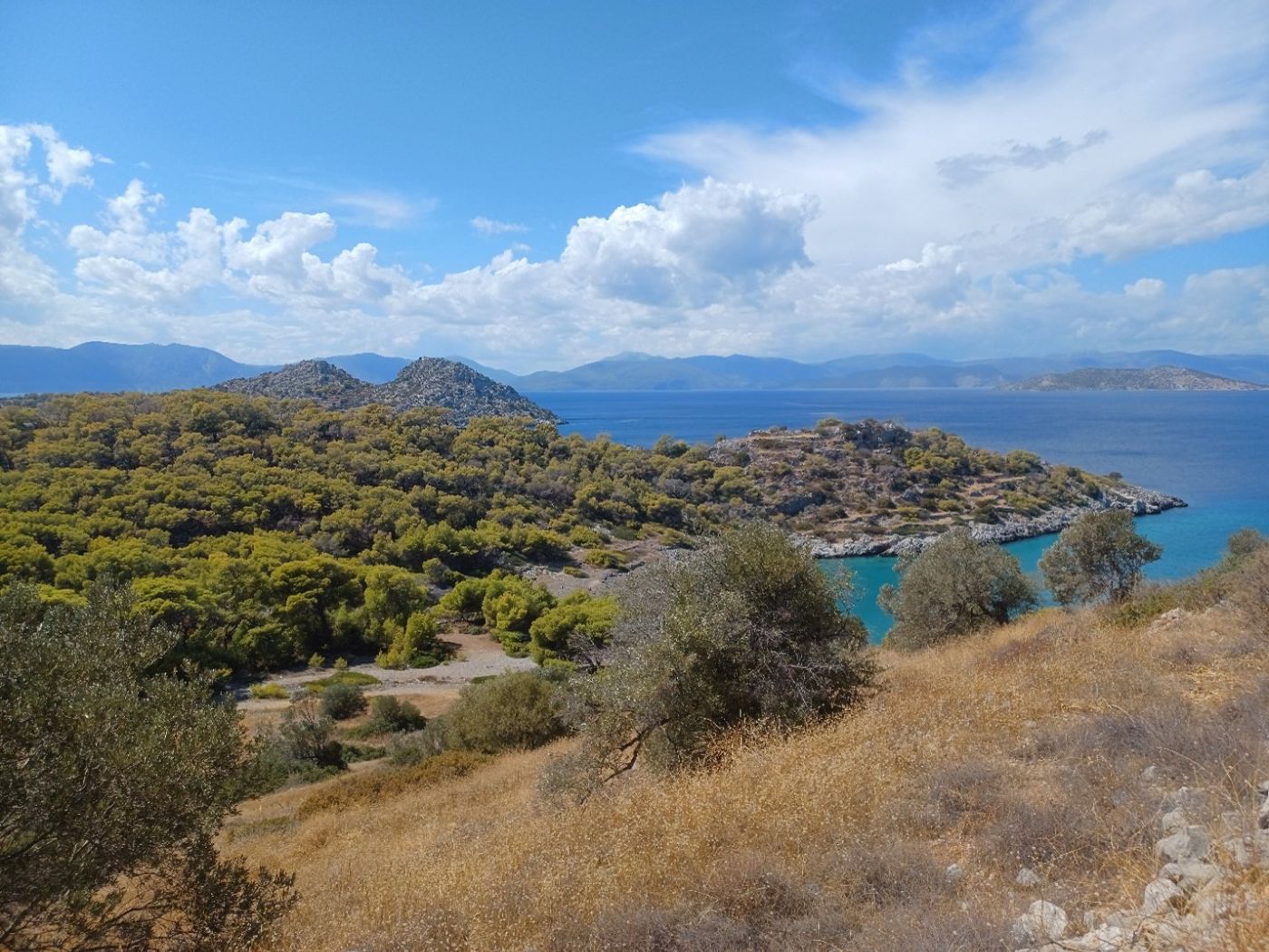
Fig. 2: Southern Anghistri. Overlooking the prehistoric site at Bariama.
Activity in the LISP study area in historical times is only slightly better known. While larger city-states are known in every direction around the Saronic Gulf, activity is so far only known from a handful of locations. Ceramic remains dating from the Archaic through to the Hellenistic period are known from the modern village of Megalochori, where ancient quarries have also been identified (Dekoulakou 2003, 73). On Kyra a preliminary investigation undertaken by the Greek Archaeological Service identified evidence of activity dated to the Classical period (Giamalidi 2014, 165–166), while a mid-5th century BCE shipwreck has been identified off the west coast of Lagousa, which carried amphorae and tile from Chios (Ethnos (07/08/09).
Given the small size of these islands, it is little surprise most were ignored by ancient writers. However, there is a vague reference to nine islets off the Peloponnese, where: “rain does not fall” by Pausanias (2.34.3), possibly islands from the study area. Most frequently mentioned is Kekryphaleia, the location of a naval battle where the Athenians defeated the combined fleets of Aegina, Epidauros and Corinth in 459 BCE (Thuc. 1.105). Two inscriptions are known from Anghistri (IG, IV. 192, 193), while another is known from Kyra (IG, IV. 194). The location of the toponym Kekryphaleia has been debated, with Pliny the Elder (4.19.4) also mentioning another nearby island called Pityonesos. Some have argued that Kekryphaleia is modern Anghistri, citing its prominence in ancient texts, however, Pityonesos likely refers to pine forests, and since Anghistri is densely covered with pines, it is more plausible that Anghistri corresponds to ancient Pityonesos. This suggests that Kyra, rather than Anghistri, may be ancient Kekryphaleia, implying Kyra may have held greater importance in antiquity.
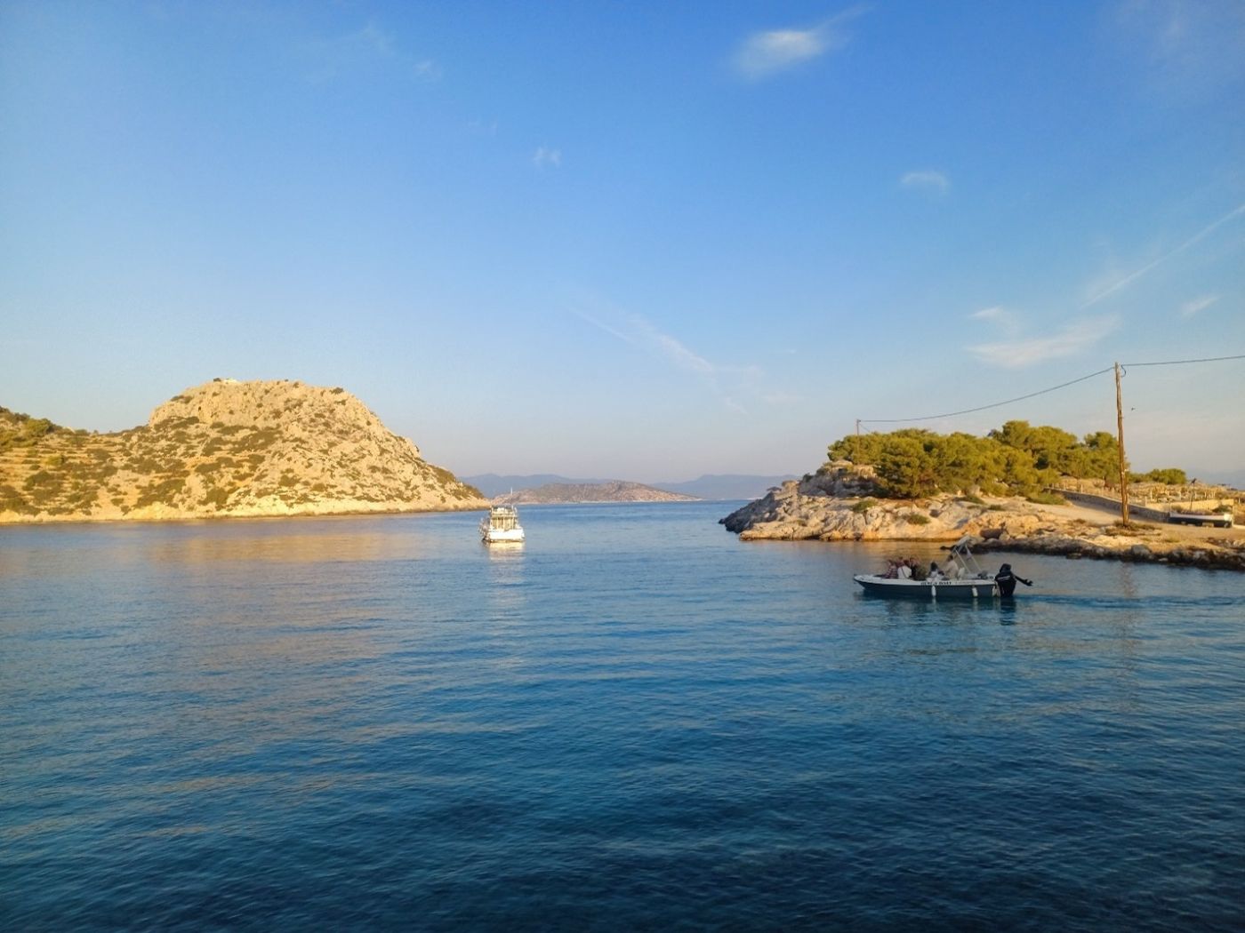
Fig. 3: The Doroussa and Aponissos islets.
Roman activity in the Saronic islands outside the study area, such as on Aigina and Methana, is well represented, particularly in the Late Roman period. Within the study area, rescue excavations have identified a Roman/Byzantine harbour at Megalochori on Anghistri (Delaporta 2001–2004, 569), while the churches of Prophitis Ilias on Doroussa (Dekoulakou 2003, 73) and Agioi Theodoroi on Kyra (Giamalidi 2014, 165–166) are suggested to have Byzantine precursors.
The Medieval period is poorly known in the study area. In the aftermath of the 1204 sack of Constantinople, the Saronic archipelago came under Frankish rule, before later alternating between Venetian and Ottoman control. It has been assumed that Anghistri was entirely abandoned in the Medieval era, to be resettled during Ottoman rule. The biggest historical event connected to Anghistri during this time is its role in the 1770s ‘Orloff Revolt’ of the Russo-Ottoman war (1768–1774). Mitromaras, an armatolos (militia leader) originally from Salamis, defected from Ottoman to Russian service upon the arrival of the Russian fleet in Poros (Ampatzi 2016, 17). For several years, Mitromaras used Salamis as a base to raid Ottoman ships before fleeing wounded to Anghistri in 1772, where he and his crew were captured and executed. A Monument to the Fallen (Μνημείο Πεσόντων) was erected near the Ag. Georgios church in Megalochori in 1814, containing the 411 men who aided Mitromaras.
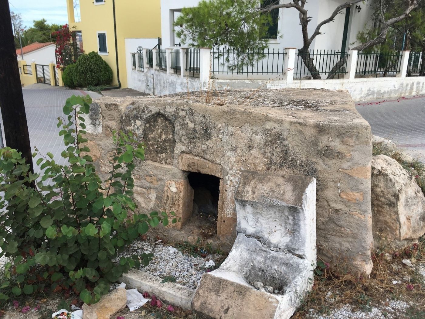
Fig. 4: The original ’Monument to the Fallen’ in Megalochori, Anghistri.
The Saronic archipelago is not only geographically significant but also holds an essential place in the historical narratives of Greece. However, the smaller islands in the Saronic Gulf, have been underexplored in formal archaeological work and most of the current information comes from anecdotal references.
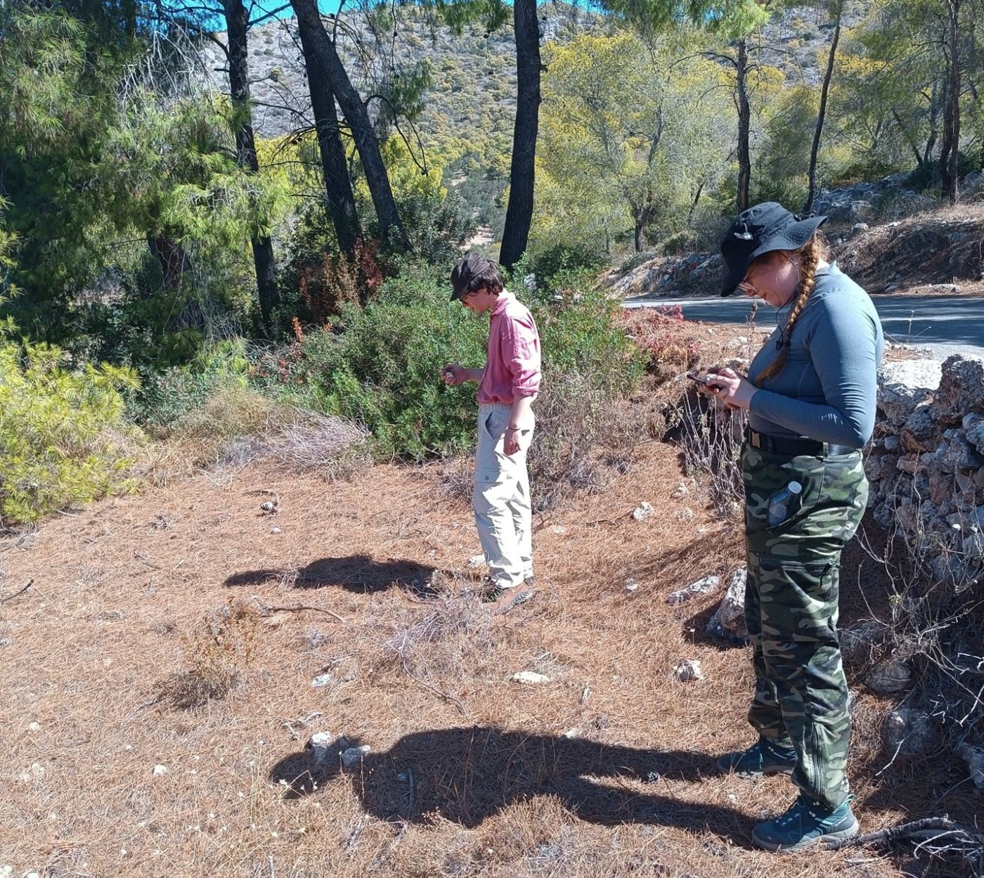
Fig. 5: Fieldwalking during the project.
The LISP project explores the fluctuating patterns of habitation, abandonment, and exploitation on these small islands, aiming to understand not only their socio-economic roles but also the unique experience of island life and how it has evolved over time. By combining pedestrian fieldwalking, geomorphological analysis, topographic mapping, and ethnographic study, the project seeks to uncover how these islands were used across different periods—whether as habitation centres, refuges, resource extraction zones, liminal shrines or marginal settlements—and what this reveals about their centrality or marginality within Saronic, Aegean and Mediterranean sea-based networks.
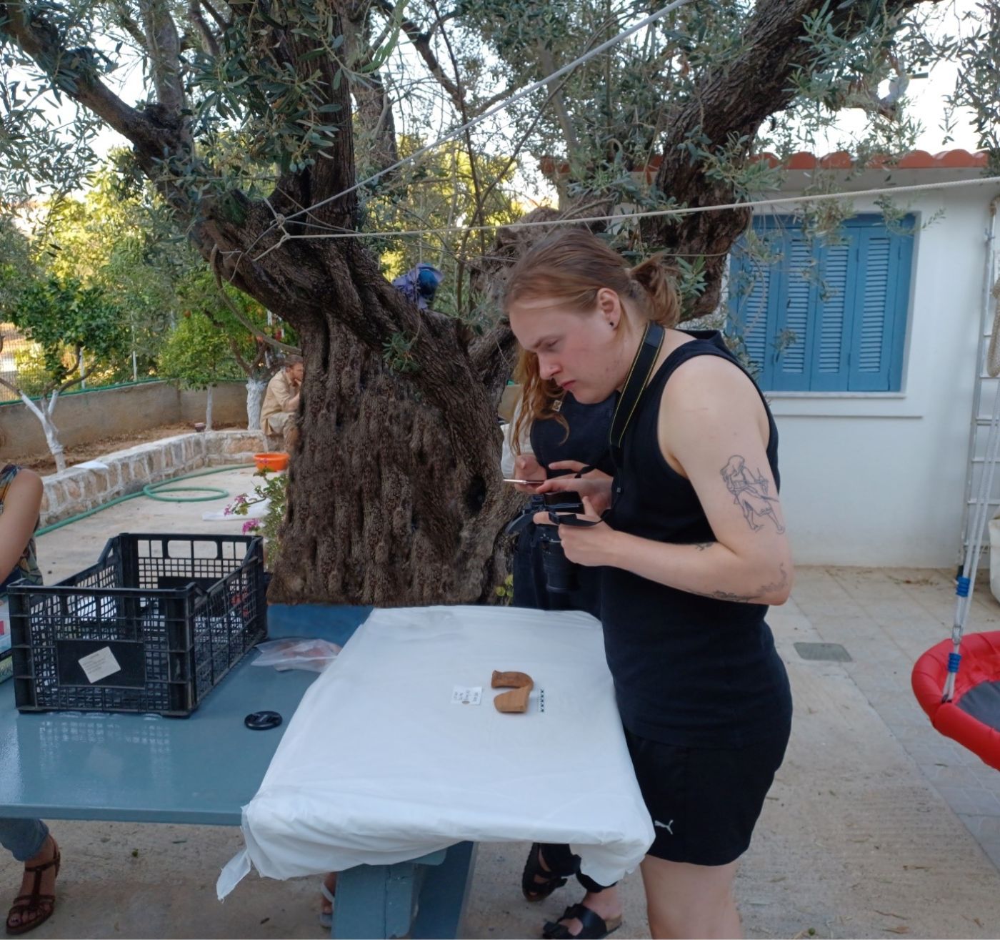
Fig. 6: Documentation of artefacts during the project.
The first season of fieldwork began in fall 2024, focused on the southern part of Anghistri and the nearby Doroussa islet. The survey identified archaeological remains from various periods, including from the Prehistoric, Classical-Hellenistic, Byzantine and Early Modern eras, subject of an upcoming preliminary report. Continued work in 2025 will expand the scope of the survey to include other small islets of the study area, while continuing to survey Anghistri island.
Bibliography
Ancient authors
Pausanias, Description of Greece.
Pliny the Elder, The Natural History.
Thucydides, The Peloponnesian War.
Modern authors
Ampatzi, Th. 2016. Το Αγκιστρι του Αργοσαρονικου. Δημοτικό τραγούδι & καθημερινότητα [Anghistri of Argosaronikos. Folk song and everyday life], Athens.
Dekoulakou, I. 2003. ‘Προανασκαφικές Έρευνες στο Αγκίστρι. Preliminary Investigations on Anghistri.’ In Argosaronikos: Proceedings of the 1st International Conference on History and Archaeology of Argosaronikos, Poros, June 26–29, 1998, edited by E. Konsolaki-Giannopoulou, 71–83. Athens.
Delaporta, K.P. 2001–2004 (publ. 2012). ‘Νήσος Αγκίστρι’ [Anghistri island], ADelt 56–59: B6, Chr. 569.
Giamalidi, M. 2014 (publ. 2020). ‘Κυρά’, ADelt 69, Chr. B1, 165–166.
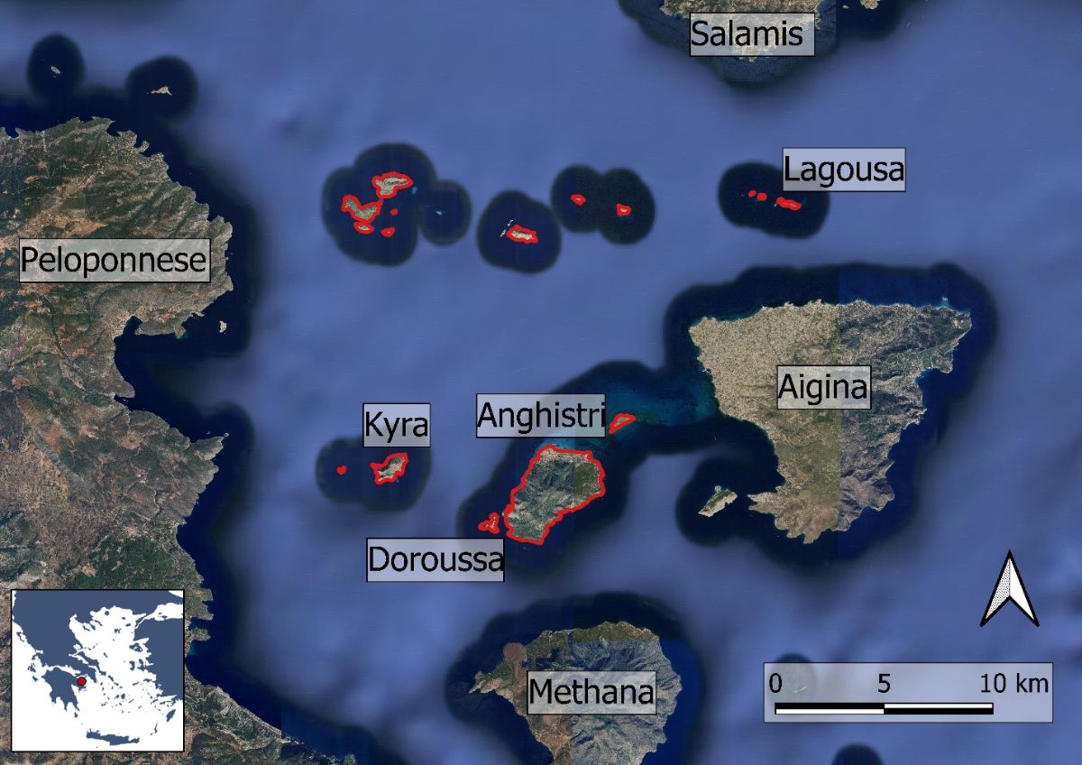
Fig. 1: Map over the Saronic Gulf, indicating the survey study area in red. (Basemap: Google maps satellite image).
Printed: 2026-05-07
From the web page: Swedish Institute at Athens
https://www.sia.gr/en/sx_PrintPage.php?export=print&tid=1087